1. Introduction
1.1 The Architectural History Practice Limited [AHP] was commissioned in September 2008 by Blackpool Council, funded by English Heritage (now Historic England), to prepare historic townscape characterisation assessments for several areas of Blackpool including Layton. The study was intended to inform the council’s management of the historic built environment, and provide an evidence base for strategic planning policy and decision- making. Layton was selected for the study in view of the high quality of its late 19th century and inter-war housing, resulting from its development principally as a residential suburb for Blackpool’s workers. This appraisal draws heavily on the subsequent characterisation report together with the Blackpool Historic Town Assessment Report published in 2005 by Lancashire County Council and Egerton Lea Consultancy.
1.2 The historic townscape characterisation exercise also recommended setting up a list of buildings of local architectural and/or historic interest (Local List). Since then the Local List has been completed; there are more than 280 locally listed buildings across the borough, 13 of which are in Layton. A map showing the location of locally listed buildings is available on the council website
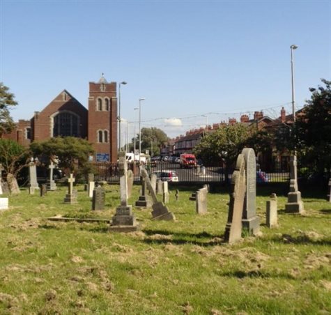
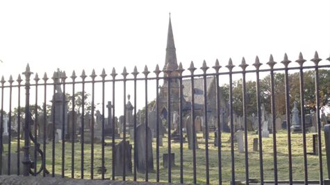
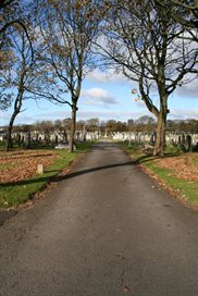
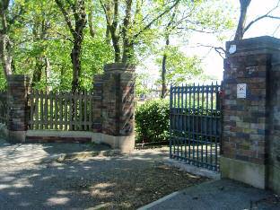
1.3 There is one listed building in the area, the cemetery chapel of 1873, which is listed Grade II. None of the area is currently a conservation area, but the characterisation study suggested that areas of particular historic or architectural interest such as the cemetery, Westcliffe Drive, and the residential streets to the east of the latter could be designated in order to control development and preserve the positive qualities of the area.
1.4 The Appraisal cannot make mention of every building, feature or space within the proposed conservation area. However, omission of any feature does not imply that it is not of any interest.
2. Policy context
2.1 A conservation area is an “area of special architectural or historic interest, the character or appearance of which it is desirable to preserve or enhance”, as set out in Section 69 of the Planning (Listed Buildings and conservation areas) Act 1990.
2.2 Under this legislation, local authorities have a duty to designate such areas and to review them from time to time. They should use their planning powers to safeguard and enhance the special qualities of these areas within a framework of managing change with a positive approach. Designation automatically entails control over the demolition of unlisted buildings, strengthens controls over minor development and gives special protection to trees within the area.
2.3 The National Planning Policy Framework (NPPF) states that the historic built environment is an irreplaceable resource, and strategies should be developed through Local Plans so that heritage assets are conserved in a manner appropriate to their significance.
2.4 The Blackpool Local Plan Part 1: Core Strategy 2012-2027 states that development proposals will be supported which respect and draw inspiration from Blackpool’s built, social and cultural heritage. Any new development will be required to protect and enhance the character, quality and setting of conservation areas and notable buildings of heritage value. Features of buildings that make a contribution to historic character but are not specifically identified also have value and should be respected in new development.
3. Context: Historical development of Blackpool
3.1 Modern Blackpool developed from the medieval manorial holdings of Bispham to the north, Layton to the south, and Marton and Carleton to the east, with each being further divided into townships. A settlement pattern of small communities within the manors probably changed little from the medieval period to the 18th century. The reclamation of mosslands, on which Blackpool is built, began in the 16th century. Following reclamation, enclosure of the land for farming led to the development of a small farming community with larger farmsteads including Foxhall and Raikes Hall; farming was supplemented by fishing.
3.2 In the early 18th century very few visitors braved the journey to the embryonic resort of Blackpool, which consisted mainly of a few humble cottages straggled along the shoreline and Fox Hall itself, a large late medieval half-timbered house belonging to the Tyldesley family[1]. By the end of the 18th century, however, the town had started to become a fashionable sea bathing resort for the wealthy, and the first visitor accommodation was built to meet this demand[2].
3.3 In the early 1820s the population, excluding visitors, was about 750. The steady growth through the first half of the 19th century was focused along a one mile stretch of coastline. However, further expansion was hampered by the town’s relative remoteness and patterns of landholding. The town became more accessible from 1846 with the opening of the Preston and Wyre branch railway to Blackpool North station.
3.4 By the 1870s the resident population of Blackpool was around 7,000 and visitor numbers were estimated at more than one million, as the decade saw the first large-scale visitor attractions promoted by entertainment companies, with large-scale theatrical presentations heralding modern show business. The first purpose-built theatre was the Theatre Royal (1868) which later became Yates on Talbot Square. In 1871 the Raikes Hall estate was sold, and the house and its extensive grounds became Blackpool’s first large scale entertainment centre which also offered indoor attractions. The Winter Gardens opened in 1878, and by the 1890s Blackpool became the resort with the greatest number of attractions in Europe, crowned by the opening of the Tower in 1894.
1 Eyre, Kathleen Seven Golden Miles Dalesman Books, 1989, p. 15
2 Talbot Square Townscape Heritage Initiative conservation area Appraisal Paul Butler Associates, p.4
4. Context: Historical development of Layton
4.1 The historic manor of Layton comprised mainly farmsteads and smallholdings owned by various wealthy families from the 11th to the 19th century, and was independent of the then small coastal town of Blackpool. Located approximately 1.5 miles east inland from the centre of Blackpool, today Layton has amalgamated into the seaside resort but retains its own identity and community.
4.2 The village of Layton bears an Anglo Saxon name meaning ‘enclosure by the water’, but it does not appear in written records until the Domesday Survey. The water was a small mere probably covering what is now Kingscote Park.
4.3 The medieval village of Great Layton was located to the south of the proposed conservation area on Layton Road, although a windmill was in existence on Hoo Hill since at least 1532. Remnants of the village consist of two locally listed cottages and a cobble wall on the corner of Newton Drive. The 1838 Tithe map shows in detail the buildings in the area including Layton Hall (a former Tudor hall rebuilt in 1750 and now demolished). A former farm track now known as Camden Road defined the northern boundary of Layton village.
4.4 Layton, as it is defined today, incorporates the historic settlements of Hoohill, Whinney Heys and Queenstown.
4.5 Detailed mapping from 1847 shows a north-south road connecting the medieval Layton village to ‘Mill Inn’ to the north, with a road to the west halfway along leading to Blackpool. The 1847 OS map also shows Hoohill windmill located opposite the Mill Inn (approximately where Tesco Express now stands at the top of Westcliffe Drive). It was destroyed by lightning in 1881.
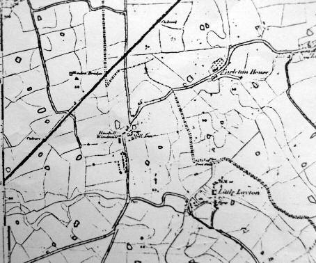
Detail of 1847 OS map (1:10560) showing the north Layton area (Blackpool Library)
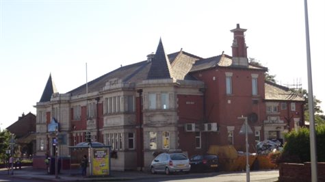
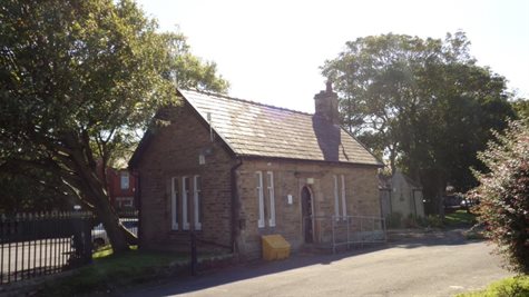
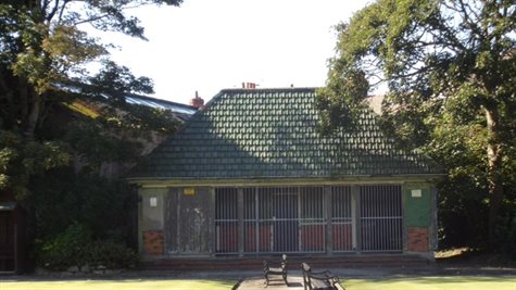
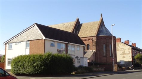
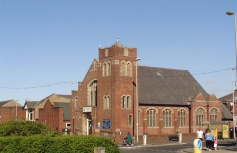
4.6 First shown on Harding’s town plan of 1877, Layton Cemetery opened in 1873 after the closure of the graveyard at St John Evangelist in Blackpool. The influx of tourism into Blackpool also led to a rise in residents, and naturally a rise in mortality rates. As a result a new cemetery was built outside of the town centre. The Queen’s Hotel on Talbot Road preceded the cemetery, opening in 1864 with a bowling green and croquet lawn.

Layton Cemetery Chapel
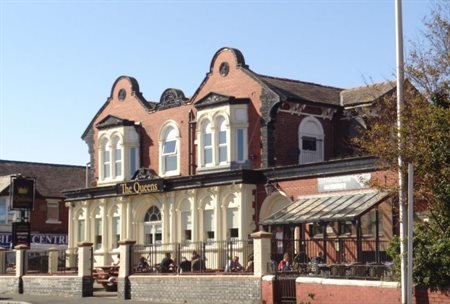
Queens Hotel, Talbot Road
4.7 The 1892 OS map also shows large buildings such as the Mill Inn (named the Mill Wheel in 1882), Layton Villa, Hoohill Farm, and a signal box and railway line to the north of the area.
4.8 The cemetery was extended northwards and a tram line was added in 1902 to link Layton and Blackpool, terminating at Layton Square where there was a shelter (now converted to toilets). Consequently there was an increase in residential development in the area aimed at Blackpool’s workers. The tramway was discontinued in 1936.
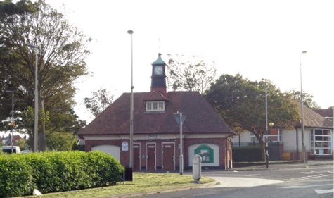
Former tram stop, now toilets
4.9 The 1912 OS maps shows some residential development had begun to occur to the north of Talbot Road on what is now Westcliffe Drive, encouraging the construction of a permanent railway station at the north end of Bispham Road adjacent to an earlier signal box; it was originally called Bispham Station (outside the proposed conservation area).
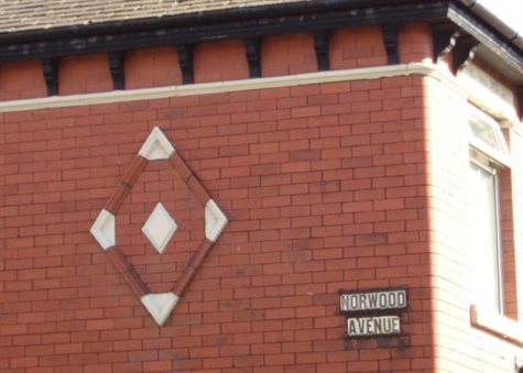
4.10 The first housing development took the form of residential avenues to the east of Westcliffe Drive, such as Brooklyn, Highbury and Norwood Avenues. Opposite these streets Layton Villa was still extant, as was the Mill Inn. Other residential streets which were developed in the early 20th century include a grid of short terraces comprising Huntley Avenue, Jackson Street and Wilford Street, all east of Westcliffe Drive.
4.11 Following the First World War residential development in Layton increased rapidly, and can be seen by comparing the 1912, 1932 and 1938 OS maps. Many of these streets comprised terraces of two-up two-down houses characterised by straight building lines. Mass produced pressed red brick and grey Welsh slate were the principal building materials.
4.12 A grid of streets north-east of Layton Square was also constructed between 1909 and 1930. Here the streets were wider and the houses planned on a looser building grain with front and rear gardens, for example Grange Road.
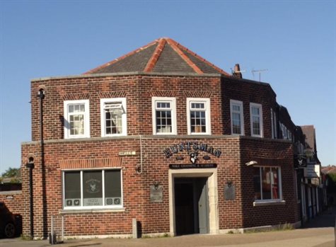
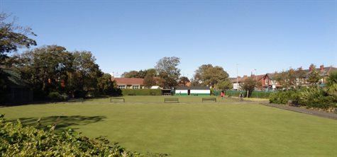
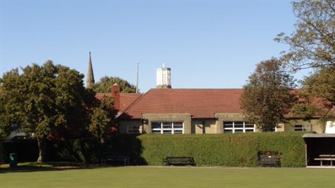
4.13 In line with this growth, several new public buildings and leisure facilities were constructed from the late 1920s, including the library designed by the Borough architect J. C. Robinson. By the early 1930s two bowling greens had been laid out to the rear of the library. The Layton Institute opened in 1926 with a bowling green at the rear. A bowling green to the rear of Queen’s Hotel on Talbot Road was built over in the interwar period.
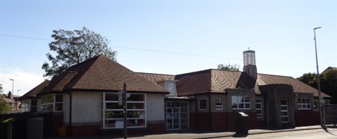
Layton Library (extended eastwards 2003)
Bowling greens viewed from the west
4.14 St. Mark’s parish church dates from 1911 when the mission hall was built on the site of Hoo Hill Mill croft at the top of Westcliffe Drive. The red sandstone replacement church was opened in 1926, and the Salem Layton Methodist Church opposite Layton cemetery was opened in 1939.
4.15 During this period purpose-built shops were also constructed on Westcliffe Drive on the corner of Annesley Avenue and, by the outbreak of World War Two, the development of Layton was virtually complete.
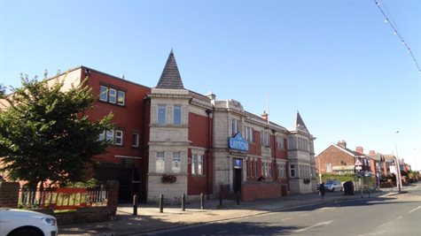
Layton Institute
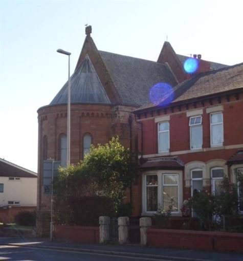
St. Mark’s Parish Church
5. Location and setting
5.1 Historically Blackpool was part of the township of Layton with Warbreck within the manor of Layton and in the parish of Bispham. Blackpool occupies a small coastal ridge with Morecambe Bay to the west and low-lying mosslands to the east and south. It lies 11 kilometres south of Fleetwood and 4 kilometres north of Lytham St Annes, and Layton is now an inland suburb located to the east of the town centre, roughly bounded by the railway line to the north, St Walburgas Road to the east, Newton Drive to the south, and Devonshire Road to the west.
5.2 The underlying solid geology of the area consists of Permo-Triassic sandstones. These are deeply masked by drift deposits and were consequently not exploited as a source of building stone. The drift cover consists primarily of glacial till deposits and post-glacial deposits of Aeolian-deposited sand and alluvium.
6. Archaeological potential
6.1 Early mapping suggests that before the Modern era Layton was mainly open farmland with few human settlements. The remains of any pre-18th century structures along the principal historic routes are unlikely to have survived constant building and rebuilding, and the current state of knowledge suggests that the archaeological potential is low within the boundaries of the proposed conservation area.
7. Proposed boundaries
7.1 It is proposed that Layton conservation area should be centred on Layton Cemetery with its grade II listed chapel. It will include views outwards from the cemetery down Grange Road, and the locally listed buildings which form the setting of the cemetery (the library, former tram stop, Queens Hotel and adjacent terraces and Salem Layton Methodist Church which is directly opposite the cemetery). It will also include the locally listed Jewish cemetery, Layton Institute and bowling green, St. Mark’s Parish Church and the immediate historic built environment which creates views through the conservation area towards heritage assets.
It will also include good examples of little altered workers housing at the north east end of Layton Road opposite the bowling greens.
8. Character
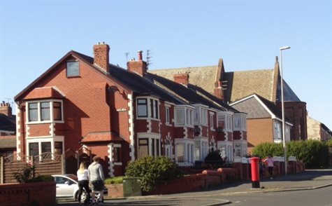
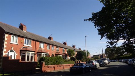
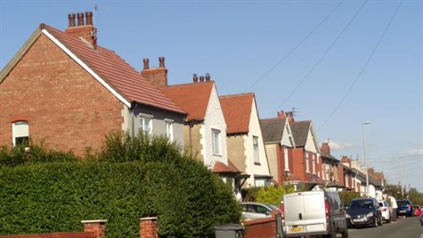
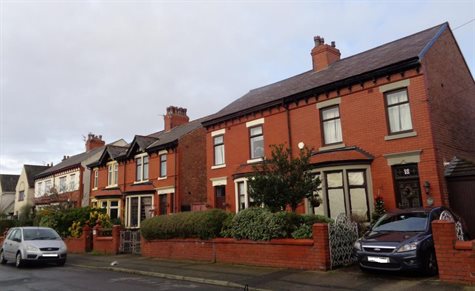
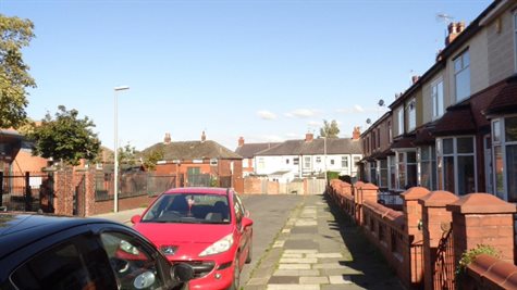
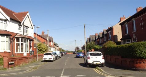
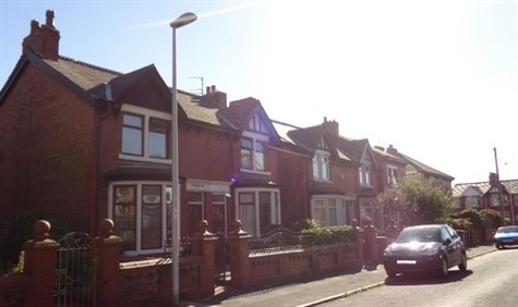
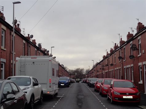
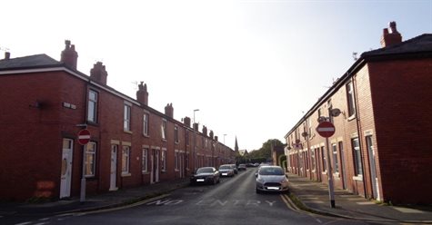
8.1 The architectural character of the proposed Layton conservation area can be summarised as a mix of late Victorian, Edwardian and interwar residential and commercial buildings including a scattering of public buildings of national or local architectural interest. Differences in residential designs and street width indicate the social status of the buildings, from terraces built on a tight grain up to the back of the footway to houses with front gardens on wider streets. The housing is typical but offers generally good examples of their time.
The main Layton cemetery, Jewish cemetery and bowling greens add important areas of green space. As a whole they illustrate the historical development of this suburb of Blackpool.
View towards Layton Methodist Church and Grange Road from Layton cemetery
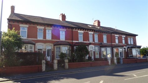
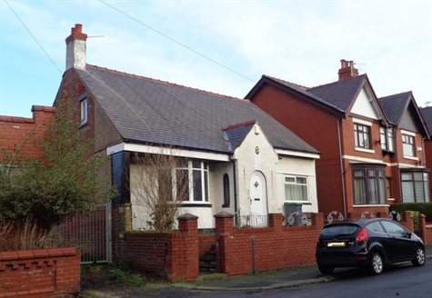
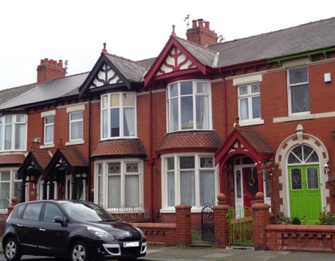
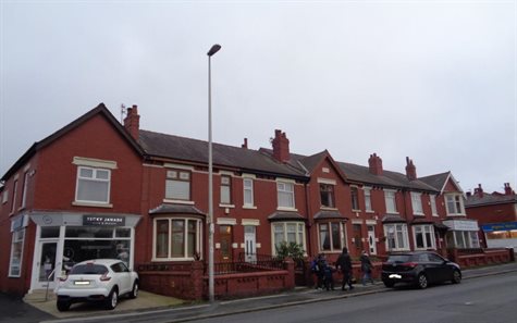
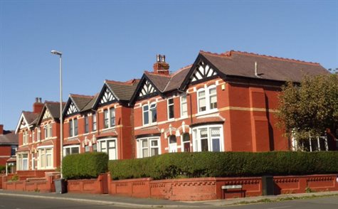
8.2 The historic core of this period of Layton’s development is centred on Layton cemetery and its listed chapel and the nearby Queen’s Hotel of 1864. The residential terraces in between with decorative window surrounds, one row of which is locally listed, are late Victorian.
View towards the junction of Westcliffe Drive and Annesley Avenue
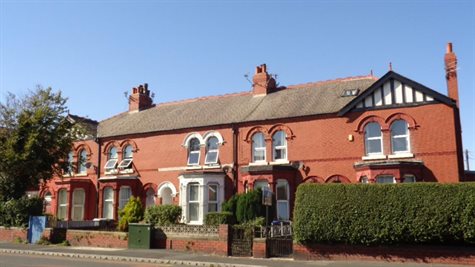
Locally listed Victorian terrace, Talbot Road
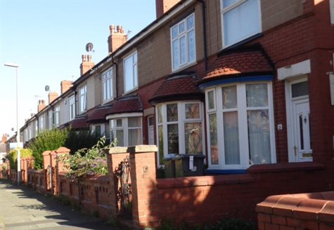
8.3 The housing types in Layton include two-up two-down red brick cottages laid out in terraces which are built up to the back of the footway. They are typical but good examples of workers’ housing built in the early 20th century, for example on William Street. This housing type usually has two rooms on the ground floor with a narrow hallway leading to stairs at the rear of the house with two further rooms above. A lean-to at the rear would house the kitchen, with a small yard leading to a back service lane.
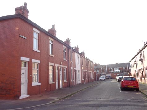
Good example of workers housing on William Street
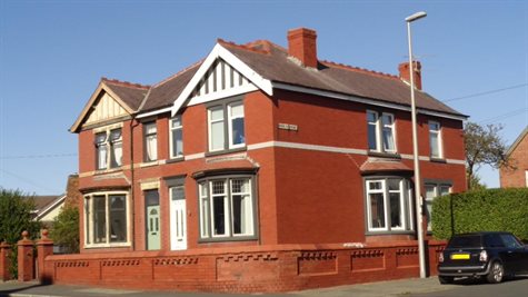
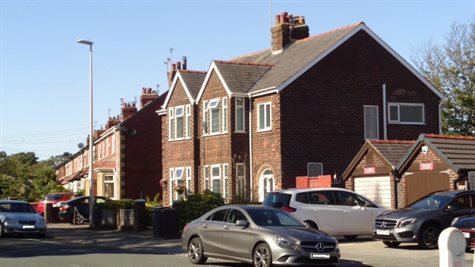
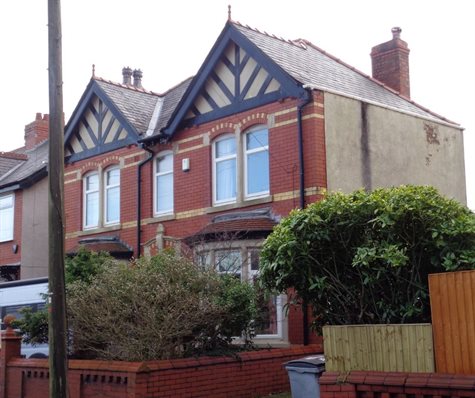
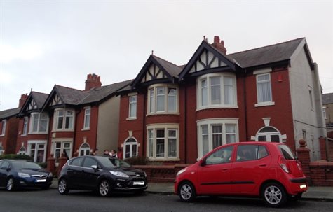
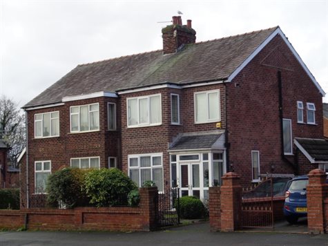
8.4 Large semi-detached Edwardian villas constructed to the north east of Westcliffe Drive opposite St. Mark’s Parish Church are built of good quality materials with bay windows, mock timber gables and small front gardens. Some also have garages.
8.5 The commercial areas of Westcliffe Drive include former residential premises converted with shops to the ground floor, and later purpose-built 1930s parades which are a typical stripped down style.
8.6 There are two churches in the proposed conservation area each with its own distinct style reflecting its age. St Mark’s Parish Church was built in 1926 in a Romanesque style in red sandstone. The related Sunday school to the rear is of little architectural merit in contrast.
The Salem Layton Methodist Church opened in 1939, is of red-brick construction with white stone dressings and has a blocky corner tower which is a strong townscape feature. Both of these churches are locally listed.
Salem Layton Methodist Church
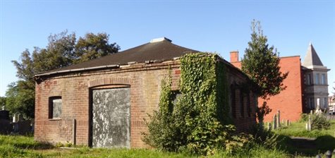
8.7 Added to these ecclesiastical buildings are two cemetery chapels: the main grade II listed cemetery chapel by Garlick, Park and Sykes (1873) in a Gothic Revival style, and the 1920s locally listed Jewish cemetery chapel in a much simpler Modernist architectural style. The latter is in a poor state of repair.
8.8 The range of interwar public buildings in Layton reflects its residential growth over a short period. Layton Institute has elements of Classical Revival detail in the terracotta faience, and the former tram shelter and bowling green pavilions have elements of vernacular architecture in their steep hipped roofs. Locally listed Layton Library is more Modernist, with squat front elevations and art-deco style ornamentation.
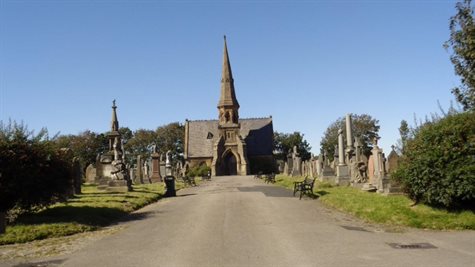
Layton cemetery chapel
Jewish cemetery chapel
9. Degree of completeness
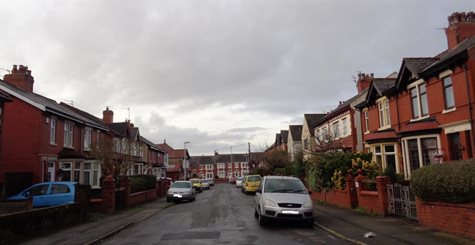
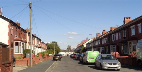
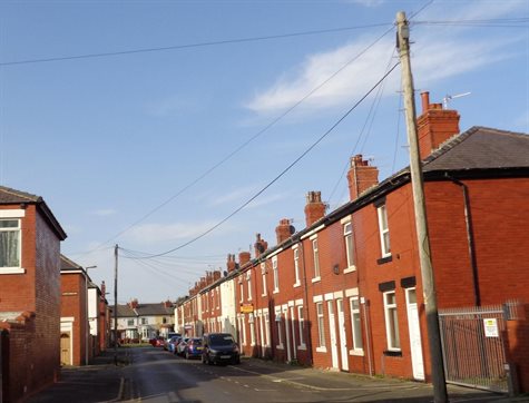
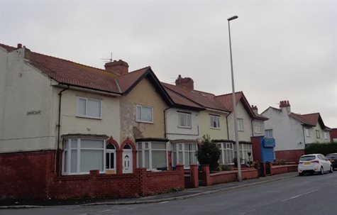
9.1 The suburb of Layton was extensively developed in the interwar years from several small settlements along historic routes. The street layouts have all been retained, despite the widening and improving of Westcliffe Drive. The overall retention of architectural detail such as bay windows, boundary walls, chimneys, and the lack of extensions or extensive alterations, supplemented by mature planting to many front gardens, gives residential Layton its character. Modern shopfronts and signage have been inserted in the shopping parades of the retail centre, but upper floors are generally intact apart from upvc windows, and building lines have been respected.
9.2 Original door and window joinery has, unfortunately, been replaced with upvc throughout the area. However, original openings are intact and the prevalence of other alterations to front elevations, in particular render or cladding, is low.
10. Materials and construction
10.1 Elevations and roofing
Red brick is the dominant material used for buildings in Layton, although variants on the common pressed brick such as a high-quality dark-red brick and yellow brick for added decoration also feature. Linear terraces were constructed as workers’ housing so decorative features are few. However, these linear qualities are enhanced by continuous pitched roofs in Welsh slate, with brick chimney stacks and some pots still extant. Stone lintels to windows and doors are usually painted, and this adds a sense of homogeneity.
On both early 20th century and interwar houses it is common for the front elevation of a house to be in Accrington pressed red brick or dark-red brick, and the side elevations to be of a much softer common brick. These would have been made locally; there were a number of clay pits in the area originally used for producing handmade brick, and by 1892 there was a brickworks to the east of Queenstown.
Dark red brown brick was used on some interwar properties with herringbone pattern embellishments to the front elevation, for example the parade of shops on the west side of Westcliffe Drive. Mock timber framing is used on interwar houses to embellish gables, and buff terracotta faience is used on the Layton Institute. St Mark’s church is built of red sandstone and is the only building of this material in the area.
Edwardian semi-detached houses with mock timber framing to gables
Roofs are usually pitched and covered in Welsh slate or red clay tiles, although there are some examples of hipped roofs such as the former tram stop. Terracotta ridge tiles are also a feature, and some gables have retained terracotta finials. In places roofs have been replaced with modern tiles, but green pan tiles are original to a pavilion at the Layton Road bowling greens. The eastern apse of St Mark’s church is covered in lead.
Brick chimney stacks are a prominent survivor in the area, and some have the added feature of terracotta pots. The clock tower of the former tram stop, and pierced cupola to the library are significant landmark rooftop features.
10.2 Doors and windows
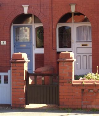
Fenestration patterns create rhythms within the street scene. Terraced streets commonly will have one rectangular window to one side of the door, and two identical windows to the upper floor, reflecting the two-up two-down plan. This regular spacing creates a pattern, which is also formed in larger houses by bay windows.
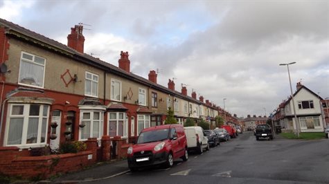
Bow windows on Lynwood Avenue
In Layton there a two main styles of bay window. These are curved (bow windows) or angular (canted bay windows). Most bay windows are single height, many with stone mullions and red clay tile roofs as seen on the Edwardian and other early residential properties. On the side streets the bow windows would have originally been timber but most have been replaced with upvc frames. Terraces have stone lintels to doors and windows.
Edwardian terrace with single storey canted bays to the north of St. Mark’s parish church
Interwar development on the west side of Westliffe Drive has double height bay windows; those to the north of Pelham Avenue were constructed on the site of the gardens to Layton Villa in the mid 1930s. The small apartment block adjacent to St. Mark’s Parish Church was built on the site of the villa c. 1970.
Interwar housing on the site of Layton Villa gardens
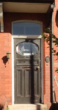
Original door Recessed doorways with arched entrance
Door joinery has generally been replaced with modern joinery or uPVC alternatives. Door surrounds are usually part of the structure although some have stone surrounds mixed with brick. Many originally were recessed with round arches, creating a porch. Some owners have moved the door forward but retain this original feature, for example on Grange Road and Grenfell Avenue. A few, for example on Grange Road, have added timber canopies with finials.

Boundary wall to Edwardian terrace on Westcliffe Drive
10.3 Boundaries
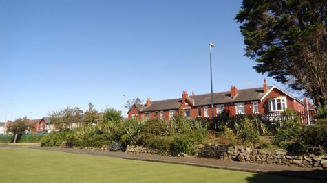
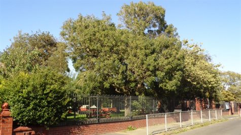
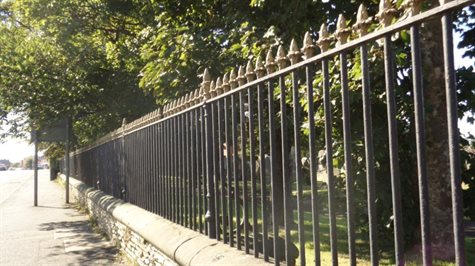
The survival of garden boundary walls is very high in Layton. Red brick boundary walls, often augmented with hedges and gatepiers, are a common and positive contribution to the streetscene in all of the residential areas. Some gatepiers are inscribed with the historic name of the property, or are embellished with terracotta roundels. Other boundaries, such as the railings to the two cemeteries, are high-quality cast iron; those to Layton Cemetery are locally listed in their own right.
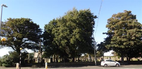
Trees in Layton cemetery
Trees around bowling greens
Trees in the cemeteries, around the bowling greens and roundabout make an important contribution to the suburban character of the area.
Although front gardens are small many have established planting which contrasts with the more austere terraces built up to the back of the footway.
10.4 Shopfronts and signage
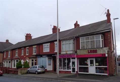
Westcliffe Drive is the principal shopping street in Layton. The survival of historic joinery to shop fronts is low and almost all signage is modern and of poor-quality design. Large and obtrusive signage detracts from what are otherwise positive buildings. Modern galvanised roller shutters are a further intrusion to shopfronts where they exist.
There are examples of better quality signage on independent shops such as 35 Westcliffe Drive, which generally have smaller signs which better reflect the proportions of the host buildings.
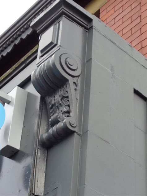
The Co-op at 15-21 Layton Road retains two timber console brackets flanking the modern fascia which may exist from an original Co-op store in this location. A good example of shopfront design can be seen at number 1 Layton Road (Ragamuffins) which retains its timber cornice, pilasters and corner entrance.
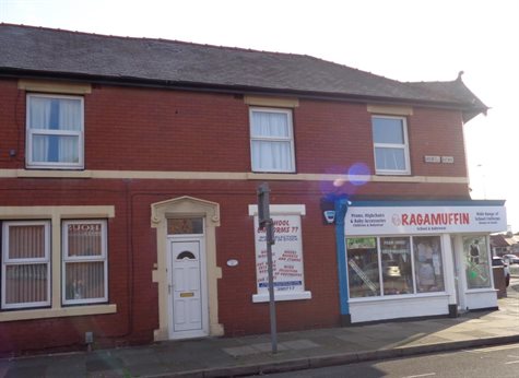
Good example of shop front design
Modern shop fronts and signage on an interwar shopping parade
Former RBS bank
Signage for the former RBS bank on the corner of Annesley Avenue are minimal, and the building retains a number of interesting original features including the corner entrance with its stone surround, and herringbone brick arches to the windows.
10.5 Street signs
In common with Blackpool itself, Layton has many street-name signs which date from a period of re-naming in the 1920s. The most attractive signs are composed of individual ceramic lettering held in metal frames of various design; there are several in Layton, although some have missing lettering.
Decorative feature and ceramic street name
10.6 Roads and footways
Modern materials are used throughout the area for surfacing to roads and footways, ranging from asphalt and Tarmacadam, through to modern stone paviours and concrete slabs. Natural stone kerbs are mixed with concrete kerb stones on the residential streets.
Variety of surface treatments and modern street furniture
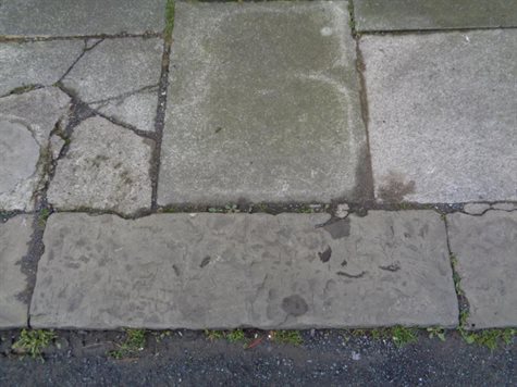
Concrete flags with natural stone kerbs
10.7 Street furniture
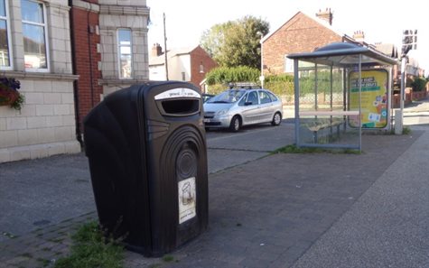
Apart from one King George V letter box there is no historic street furniture in Layton, and it has generally all been replaced with modern metal and plastic models during recent public realm improvements. These include large metal rubbish bins, timber and steel seating, and tall lampposts with banners and ‘Layton’ pierced and illuminated on the post. Street furniture dating from the 1970s and ‘80s is typical of its type; concrete or galvanised lamp standards and concrete or steel bollards are common. There are a large number of poles giving highways information such as speed limits. There are often two in each location which creates visual clutter, and these are a negative feature in the townscape.
Cluttered street scene with duplicated speed signs, pedestrian barriers etc
Waste bins outside Layton Cemetery
The bus network is an important factor in connecting Blackpool Town Centre and its outer suburbs, so modern glass and steel bus-stop shelters are common in the area. Bus stop signs and modern rubbish bins are usually related to the bus stops. The waste bins close to the entrance of Layton Cemetery are a particularly intrusive feature.
King George V letter box
11. Views and open spaces
11.1 Due to the inland position of Layton and its planned use as a residential suburb, open spaces are relatively common and the general layout of the built environment is characterised by good spatial quality.
The most common spatial feature is the width of late 19th century and early 20th century streets in the area. On the earlier streets, ranges of terraces are built on a tight grain up to the back of the footway with small rear yards to service streets, creating a positive homogenous linear feel to streets, enhanced by lack of alterations to the front of houses.
Later larger houses on avenues have front gardens and, combined with the street width, form attractive and wide vistas, for instance down Grange Road.
11.2 On the east side of Westcliffe Drive the residential east-west streets form grids or ladders, framing views into and out of the proposed conservation area. The spire of the Layton mortuary chapel, the tower of the Salem Layton Methodist Church and St Mark’s church are prominent in views into and through the south end of the area. Layton Institute, despite its central location, is on a curve and is visible mainly in views from Onslow Road and from the junction of Norwood Avenue and Westcliffe Drive.
View down Grange Road from Westcliffe Drive
View of Layton Institute from Onslow Road
View towards Layton Institute from Norwood Avenue
There are a large number of open spaces in the area, supplemented by small patches of green at road junctions. Layton Cemetery comprises the largest amount of open space in the area. The railings along the Talbot Road boundary allow views in towards the chapel, but otherwise it is largely confined by its boundary walls and planting along the north, east and west sides.
View into the cemetery from the junction of Talbot Road and Westcliffe Drive
View north east from within the cemetery
There are views outwards from the cemetery towards Salem Layton Methodist Church and down Grange Road. The small scale of memorials in the cemetery allows views around the site, and these are added to by avenues of trees. Although enclosed by residential development the cemetery itself is an important spatial asset. This sense of spaciousness is increased by the large roundabout opposite, which also contributes to the green space in this location.
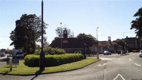
Roundabout at the junction of Talbot Road, Westcliffe Drive and Layton Road
Bowling greens behind the former tram stop
View towards the shops at the north end of Layton Road
Other important green spaces are the Jewish cemetery and the three bowling greens which were provided for recreation in the interwar years, two on Layton Road behind the former tram stop, and one behind Layton Institute. A further green and croquet lawn behind the Queen’s Hotel on Talbot Road is now a surface car park. The retention of these spaces not only adds to the character of the area, but is an ongoing reminder of the facilities provided for residential areas in the 1920s and ‘30s. They have a strong local and social significance.
Jewish cemetery
12. Architectural character of individual streets
12.1. Annesley Avenue
Annesley Avenue is a residential street running northwest off Westcliffe Drive and linking it with Mansfield Road. The street has a serpentine layout and is quite wide, although traffic calming measures have been added at the south end.
Numbers 6-26 are positive as they have generally consistent features, such as ground-floor canted bay windows and chimney stacks, and the majority retain their original boundary walls and front gardens. There is a service road to the rear of the terrace. The houses face the east boundary wall, railings and hedge of Layton Cemetery and therefore contribute to its setting.
Numbers 2-4 are a pair of later interwar semis, with a dark red brick used to face and decorate double-height bays and the front elevation. The boundary wall has been removed, but this is still an attractive house and positive in merit.
Numbers 1-25 and 30-36 are semi-detached houses with long rear gardens backing onto the cemetery. However, they comprise a mixture of architectural styles and many are altered, and it is proposed to exclude these from the conservation area.
Numbers 6 – 26 Annesley Avenue looking towards Salem Layton Methodist Church
Numbers 2 – 4 Annesley Avenue looking west
12.2 Brooklyn Avenue
Brooklyn Avenue is an east-west residential street with quite a wide aspect with views west towards St Mark’s Church. It is characterised by a mix of houses of size, style and age; the detached houses on the north side probably date from the 1910s, while those on the south side of the street were probably built in the 1920s. Although many retain front gardens with boundary walls which provides some cohesion to the townscape, there is some alteration to front elevations particularly on the north side. Street surfaces are modern with concrete lampposts and timber telegraph poles.
There are some attractive examples at the west end of the street but overall the street is neutral in value as it does not have the strong linear qualities and unaltered appearance of other streets of its type. However, it is directly opposite the locally listed St. Mark’s Church, and as such contributes to its setting and views into and out of the conservation area.
Therefore it is proposed that numbers 2 – 22 and 1 – 23 are included within the boundary so that the views can be preserved and enhanced, beyond which the street slopes down and the buildings are highly altered.
North side of Brooklyn Avenue looking east
Brooklyn Avenue looking east
Good example of a detached dwelling with architectural detailing
12.3 Highbury Avenue
Highbury Avenue is a wide residential east-west street characterised by a variety of semi- detached and terraced houses of different styles, ages and sizes. For example numbers 1-13 on the south side are part of the same build, red brick with ground floor stone bow bays and bracketed timber eaves, and the central pair have twin gables to the roofline. Numbers 23 and 25 are detached modern houses, and numbers 31-39 are an altered terrace, which slopes downhill at the east end. All of the properties have short front gardens with boundary walls to the back of the footway. The view to the east is terminated by Eastwood Avenue.
The properties on the north side have similar build and design qualities as the south, with a mix of stone bow bays, semi-detached houses with twin gables, and rendered properties at the east end. The semi-detached pair numbered 4 – 6 is an unusual design on this street being rendered with a steeply pitched Westmorland slate roof. The altered terraces at the east end are beyond the view from Westcliffe Drive.

North side of Highbury Avenue
North side of Highbury Avenue looking from the east end
Highbury Avenue has good linear qualities, and the houses retain most of their architectural detail so is generally of positive value. However, the altered terraces at the east end will not be included within the proposed boundary.
Highbury Avenue looking towards Westcliffe Drive
12.4 Lynwood Avenue
This is an east-west cul-de-sac with a wide aspect, with terraces on the south side and substantial good-quality semi-detached houses on the north side. Layton Primary School is situated at the north east end. The terraces on the south side are divided in half by a service road. All houses have short front gardens with brick boundary walls to the back of the footway, some augmented by hedges, and the roofline is characterised by extant chimney stacks and pots.
View east down Lynwood Avenue
The houses are characterised by different detailing: numbers 56-62 are red brick with rectangular ground floor bays; numbers 26-54 are rendered to the first floor and have ground floor bow windows all now with upvc frames.
Numbers 2 – 24 and 1 – 19 have stone bay windows and most retain recessed porches with a keystone above the arched entrance. On the north side the pairs of semis are slightly raised from street level, of brick construction with ground floor stone bow bays. Numbers 7-11 have stone and brick details to the doorways, and each house has a good-sized front garden with brick boundary walls to the back of the footway with gatepiers, some retaining terracotta ball finials. All bay windows retain red clay tile roofs, a prominent feature throughout the conservation area which contributes to its character.
North side of Lynwood Avenue viewed from Westcliffe Drive
Recessed pair of doorways
North east side of Lynwood Avenue South east side of Lynwood towards school
The rear of numbers 14 - 24 Melrose Avenue terminate views eastwards and these are a negative feature. Nevertheless, Lynwood Avenue has strong linear qualities and the houses retain much of their original detail. The trees in the grounds of Layton Primary School add to the leafy character at the east end. The street is therefore of strong positive value.
View of rear of properties on Melrose Avenue at the north end
Playground to Layton Primary School
12.5 Norwood Avenue
This street is a short cul-de-sac of substantial red-brick pairs of semi-detached houses, terminated at the east end by a boundary wall to Layton Primary School. Most of the houses have ground floor stone bow bays, and some and are characterised by gables to the street elevation. All have good sized front gardens with brick boundary walls and gatepiers, augmented by hedges or planting.
View east down Norwood Avenue
Number 1 is a small detached property but probably of the same build and has an attractive garden. Number 4 is a bungalow raised above street level and is dated 1910. It is rendered with a central gabled porch. The houses on the avenue have good architectural qualities and, apart from replacement windows, is an attractive suburban street of positive value.
West end of Norwood Avenue
4 Norwood Avenue
12.6 Melrose Avenue
Melrose Avenue is a north-south cul-de-sac between Layton Primary School and Onslow Road, and has a narrow aspect, widening at the north end where there are four pairs of interwar semi-detached houses. The latter have a high level of alteration and are not proposed for inclusion.
The rest of the street comprises good examples of red-brick terraces built up to the back of the footway, with Welsh slate roofs and brick stacks with terracotta pots. It has good linear qualities and, apart from replacement windows, retains much of its original character.
The street surface is modern, but there are a majority of natural stone kerbs. Overall the street is positive in value.

Melrose Avenue looking north
12.7 Drummond Avenue and Broughton Avenue
These two streets are good examples of purpose-built working class housing constructed in the early 20th century. They are the same in character and form, having quite a wide aspect sloping downhill at the east end, and comprising rows of red-brick two-up-two-down terraced houses built up to the back of the footway. The character is enhanced by a continuous building line, and retained chimney stacks create a unified roofscape which makes a strong positive contribution to the character of the streets.
Drummond Avenue looking east
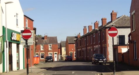
The east end of Drummond Avenue is crossed by a service street which cuts between the terraces and their adjacent slightly later semi-detached neighbours. At the west end there are small garage-sized properties in commercial use.
Number 80 Broughton Avenue is a detached late 20th-century bungalow to the east of the service street, which it is proposed to exclude from the conservation area.
At the west end of the street, the side elevation of the Co-op is a negative feature in the townscape.
The houses on both streets generally have replacement windows but no extensions or excessive alterations. Street surfaces are modern, although there are some natural stone kerbs. The linear aspect of the streets and lack of alterations give them both strong positive townscape value. The main issue which undermines the historic character of these streets is the fixing of satellite dishes on front elevations.
Side elevation of Co-op, Broughton Avenue
Broughton Avenue looking east
Broughton Avenue looking west towards Layton Square
12.8 Grange Road
This street has a wide aspect, with the landmark features of Layton Cemetery Chapel and the Salem Methodist church at the west end, sloping down at the east to long views across Kingscote Drive (beyond the proposed boundary). The north side is intersected halfway by Wilford Street. Grange Road has very strong positive townscape qualities. The street comprises ranges and terraces of two-storey red brick houses, with pitched Welsh slate roofs and intact brick chimney stacks. The houses have good sized front gardens with brick boundary walls to the footway, and many have retained gatepiers with terracotta ball finials. The houses have recessed doorways, and different bay-window treatments; for example, on the north side numbers 1-29 have stone canted ground floor bays and numbers 31-52 have double height stone bow bays with timber bays to the first floor, although generally window frames have been replaced with upvc.
On the south side the different styles continue, with numbers 42-48 being a pair of semi- detached houses with mock-timbered gables above stone bow bays, and there are various other different doorway treatments, numbers 12-14 being a good example.
Attractive porches and gables on Grange Road
Double height stone bays and decorative gables on Grange Road
12.9 Grenfell Avenue
This street is characterised by blocks of terraces, divided on the north side by a series of intersecting streets and service lanes. The west end, before Wilford Street, is narrow and comprises red-brick two-up-two-down terraces built up to the back of the footway, in common with other east-west streets. Numbers 5-11 are semi-detached houses flanked by detached properties with bow windows to the ground floor and front gardens. From here there are good views of the cemetery chapel.
Grenfell Avenue looking west towards Layton Cemetery from the junction with Wilford Street
Beyond Wilford Street the street widens, bends slightly to the south, and slopes gently downhill, terminated by pairs of semis on the east side of Kingscote Drive. Here the houses are the same as numbers 5-11, or have stone double-height bays with brick boundary walls to the back of the footway. Most of the gardens are maintained and attractively planted. This street has positive townscape value.
However, one of the main ways that conservation area designation is intending to preserve the character of the historic core centred on Layton cemetery and Westcliffe Drive is by preserving and/or enhancing views, and therefore it is proposed to exclude Grenfell Avenue beyond Wilford Street because views of Layton chapel disappear thereafter.
View east down Grenfell Avenue from the junction of Annesley Avenue/Westcliffe Drive
Huntley Avenue from the junction with Westcliffe Drive
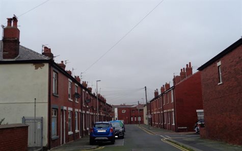
12.10 Huntley Avenue and William Street
These are two short streets with a service lane at the west end and views to the east terminated by houses on north-south Wilford Street. Both streets have red brick two-up - two-down terraces on both sides, built up the back of the footway. There is little alteration apart from replacement windows. Retained chimney stacks and the linear qualities of the streets give them positive value.
Service lanes to the backs of the terraces are of less positive quality, but are an important part of the historic grid layout of the area. There are also good views of the Jewish cemetery from Huntley Avenue.
William Street
12.11 Onslow Road
Onslow Road runs east from Westcliffe Drive opposite the Layton Institute, and continues beyond the proposed boundary. North-south streets join Onslow Road at a bend about half way down the street. At the west end it has a relatively wide aspect with terraces on both sides. The terraces are generally red brick, with small front gardens and brick boundary walls to the back of the footway, some augmented by hedges. Numbers 1-31 are rendered to the first floor and have bow windows to the ground floor, all with upvc frames. Numbers 33-87 have rectangular brick ground floor bays containing paired doorways.
Numbers 8-26 are standard two-up-two-down terraces with no embellishment although, unusually for this type of terrace in the area, they have small front gardens which adds to the more open aspect of the street. There is a small grassed area at the apex of an island site where the road splits to form Lyncroft Crescent. Most windows have been replaced and all street surfaces are modern. The street is generally positive in value. However, it is proposed to include only those terraces which form views to and from the Layton Institute on Westcliffe Drive, that is numbers 8-26 ,and numbers 1-31 Onslow Road which are also visible in views north down Wilford Street.
1 – 31 Onslow Road view views of the side elevation of 28 Onslow Road
8 – 26 Onslow Road viewed from Westcliffe Drive
12.12 Lyncroft Crescent
This is a short intermediate street which curves around an island site of properties on this street and Onslow Road. Overall the street is neutral in value as it has the character of a thoroughfare rather than being residential, and has no definition compared to the surrounding streets. The club numbered 1 – 3 is a negative feature in the townscape, as are the rear of the properties on Onslow Road. The majority are also beyond the views from the Layton Institute except numbers 2 and 4 Lyncroft Crescent. Only the latter will therefore be included in the proposed conservation area. This location also includes views of the rear of Jackson Street and Wilford Street which are a negative feature.
4 Lyncroft Crescent showing the rear of Jackson Street and Wilford Street
12.13 Wilford Street and Jackson Street
These north-south streets are part of the grid forming short east-west streets to the east side of Huntley Avenue. Wilford Street is important in the grid layout but is not a major thoroughfare, and is mainly composed of the side elevations of end properties on the east- west streets, except for the range Nos 2-46 which is a red-brick two-storey terrace built up to the back of the footway.
Jackson Street comprises three long ranges of two-up two-down terraces as on Wilford Street. Some of the Wilford Street properties are rendered, but both streets retain their linear qualities and fenestration pattern; these streets are positive.
All street surfaces are modern, with concrete lampposts, although there are a few natural stone kerbs.
Wilford Street looking north towards Onslow Road
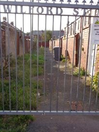
Alleygate on Wilford Street
Jackson Street
13. Commercial
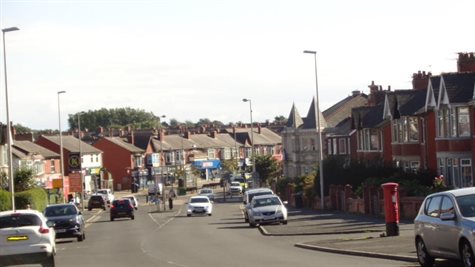
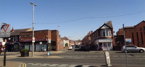
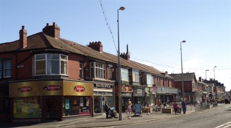
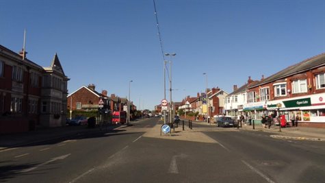
13.1 The commercial heart of Layton is centred on Westcliffe Drive and the north end of Layton Road which together were an historic route linking medieval Layton village and Hoo Hill, and is now a busy transport route. It is a roughly triangular area including the two cemeteries and three bowling greens.
Junction of Layton Road and Westcliffe Drive looking north
Granby Avenue and Annesley Avenue create a triangular site to the west of Westcliffe Drive, upon which the Layton Institute and its bowling green and the Jewish Cemetery are located. Granby Avenue is a typical residential street of little architectural merit and is excluded from the proposed conservation area.
Layton Institute
Layton Institute and bowling green are locally listed, and the bowling green also provides important recreational space.
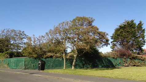
13.2 Jewish Cemetery
Located on the west side of Westcliffe Drive, the Jewish Cemetery was established in 1898. It is bounded on all sides by hedging and walls, with the backs of numbers 6-26 Annesley Avenue to the north. Although it is much smaller than the main cemetery, it is an important open space in Layton. It retains its original boundary walls and railings (which were moved back in the 1960s when Westcliffe Drive was widened) and includes several interesting memorials, and a brick Ohel (chapel) which is locally listed. The latter is no longer in use and in a poor state of repair. The cemetery is significant for religious and social history reasons and is a positive townscape feature. The trees in the burial ground also contribute to the suburban character of the area.

Jewish cemetery
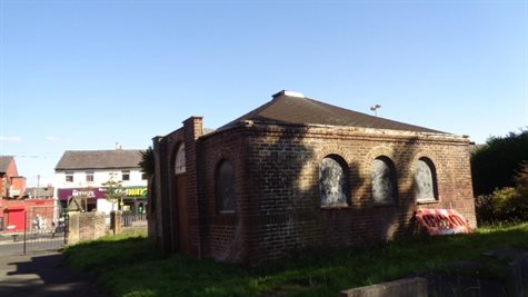
Jewish cemetery chapel
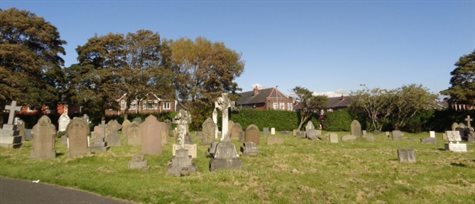
13.3 Layton Cemetery
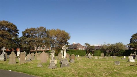
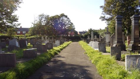
Now encompassing 30 acres, Layton Cemetery opened in 1873 and was one of the reasons for the growth of residential Layton prompting the installation of a tramline from Blackpool. It remains the principal burial ground for Blackpool but is also important as one of the largest open green spaces in the district.
Locally listed lodge now used as an office
The burial ground and Edwardian lodge near the entrance are locally listed. Several notable individuals are buried in the cemetery including Dick Barlow, an England Test Cricketer; Samuel Laycock, a local dialect poet; Alfred Tysoe, a British athlete who won two gold medals at the 1900 Olympics; John Bickerstaffe, a former Mayor of Blackpool and founder of the Blackpool Tower Company; and John Grime, founder of the Blackpool Gazette. The Barlow and Bickerstaffe memorials, along with a war memorial in the centre of the cemetery, are locally listed in their own right and there are numerous other memorials which are finely executed.
The cemetery is significant for its local and personal family history connections, and also as a large open space important to Blackpool’s community. The chapel spire is a landmark feature, and the cemetery has very strong positive townscape value.
The cemetery is bounded by brick walls and planting on all sides, with the backs of houses on Annesley Terrace to the east and partially North Avenue to the west. The principal entrance is to the south facing Layton Library, and retains its original stone gatepiers and pedestrian gates. The boundary wall, railings and gates are locally listed.
The north entrance to Mansfield Road has cast-iron gates of typical interwar design contemporary with the cemetery extension, and is bounded by brick walls with piers capped with moulded concrete, between which are concrete railings. These are covered by the burial ground’s local listing.
Layton’s only listed building, the cemetery chapel opened in 1873 by Garlick, Park and Sykes and listed Grade II, lies within the confines of the cemetery. Two further chapels for Nonconformists and Roman Catholics were demolished many years ago.
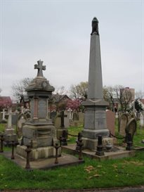
Bickerstaffe memorial Richard ‘Dick’ Barlow memorial
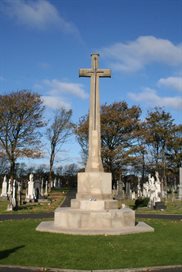
Locally listed WWI war memorial View north from the chapel
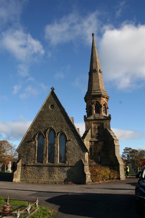
Layton Cemetery Chapel
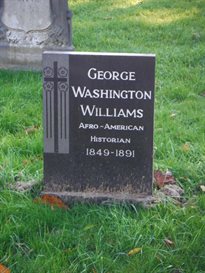
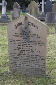
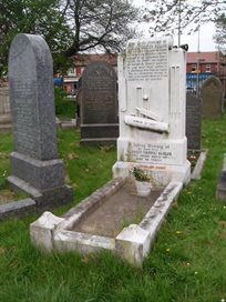
Gravestone of George Washington Williams Gravestone of Maria Vero
American Civil War veteran associated with member of the National Society for Women’s Suffrage the anti-slavery campaign.
Boundary treatments to the Mansfield Road edge of the cemetery
Locally listed railings on Talbot Road
13.4 Layton Road
The west side within the proposed boundary is largely taken up by two bowling greens located on a triangular site at the junction with Talbot Road and Westcliffe Drive. The greens are surrounded by laurel hedging and modern galvanised fencing, but are important as an undeveloped space in the area and they have a strong positive place in the townscape and community.
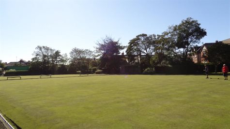
Bowling greens
Library lantern and cemetery chapel spire viewed from the bowling green
There are several pavilions to the greens, of different dates; that on the west side is probably interwar and has a steep green pantile hipped roof. There are also several attractive cast-iron and timber benches around the greens. The space is attractively planted with shrubs and flowering plants and is well-maintained. Footpath surfaces are modern.
Bowling green pavilion
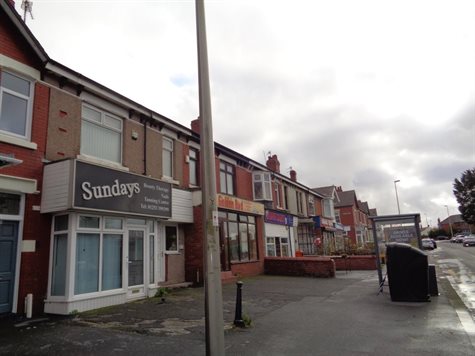
Numbers 1 – 51a on the east side of Layton Road within the proposed boundary has positive townscape value. Modern interventions such as deep fascia boards and signage to shops have a detrimental impact on the buildings, but this is mostly superficial and could be remedied with improved shopfront design and signage.
Numbers 1 – 21 Layton Road viewed from opposite the Grange Road junction
Decorative red clay tile roof covering to 1 – 21 Layton Road
Console bracket on Co-op frontage
The terrace numbered 1-21 is a two-storey parade given over to commercial premises on the ground floor and there is no boundary to the back of the footway. The Co-op at numbers 15-21 has a modern shopfront and fascias, although timber cornice brackets have been retained. Some of the properties have timber oriel bays to the first floor. The continuous red clay roof with intact chimney stacks makes a positive contribution to historic character.
Numbers 23-39 between Broughton Avenue and Drummond Avenue contribute to the setting of the bowling greens. Recorded on a datestone as built in 1914. They are also mostly commercial with display space on forecourts. This block is heavily altered, and rendered properties undermine the unity of the brick terrace. However, the roof is slate with retained chimneys and the brackets to the eaves are also mostly retained. Improved shop front design and signage would enhance the block.
Numbers 23 – 39 Layton Road
Numbers 41 – 51a Layton Road
Numbers 41 to 51a is the most southerly block which forms the setting of the bowling greens, and is residential apart from a shop on each corner. It is a good example of interwar housing with bow windows and hoodmoulds to the doorways. It has a continuous slate roof and intact chimney stacks. The block has positive value.
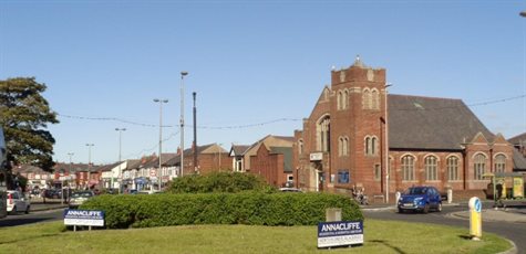
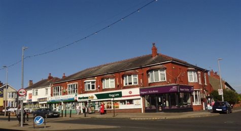
13.5 Talbot Road/Layton Square
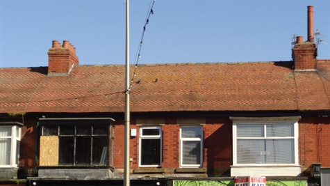
Talbot Road at the east end widens on its approach to Layton Square with good views of the Salem Methodist Church. Layton Library and the former tram stop, now public WCs, on the east side of the square are locally listed. The tramway ran up Talbot Road to Layton from 1902. The Queens Hotel on the west side of Talbot Road and the adjacent terrace of late Victorian houses are also locally listed. Layton Square and this stretch of Talbot Road is positive in townscape value.
Numbers 283 – 291 Talbot Road
Numbers 283 – 291 Talbot Road, although contemporary with 273 – 281 Talbot Road, are not included in the local listing because of alterations to number 283, although the block overall makes a contribution to historic character.
The south side of Talbot Road in this location comprises mixed architectural styles reflecting different periods of development, and there is some level of alteration, in particular numbers 442 – 458, which first appear on the 1912 OS map and are therefore contemporary with the early residential development at the north end of Westcliffe Drive, probably in response to the tramline being laid in 1902. Due to the level of alteration it is proposed to exclude this block from the conservation area.
Numbers 442 – 458 Talbot Road
Numbers 460 – 470 first appear on the 1932 OS map and feature stone bow windows and arched entrances with hoodmoulds. This block marks the start of the commercial centre of Layton on this street, and it is visible from the Layton cemetery.
Numbers 460 – 470 Talbot Road
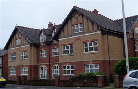
Stonemasons Court is a modern apartment block with ‘Tudorbethan’ features. It is out of scale with the historic environment and is therefore neutral. Number 476 Talbot Road is an Edwardian detached house with many original features, and is of positive value.
Stonemasons Court
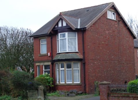
476 Talbot Road
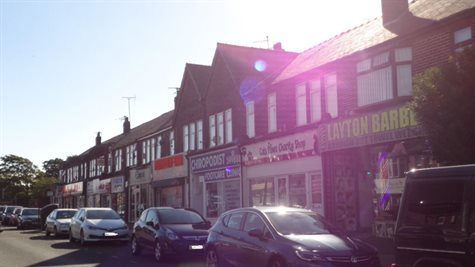
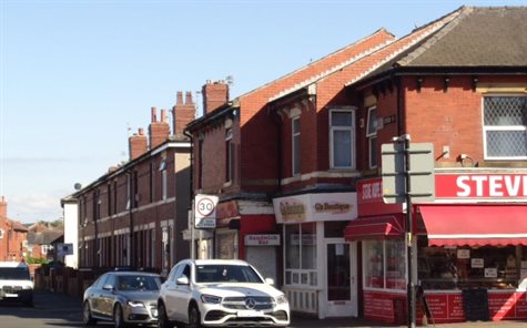
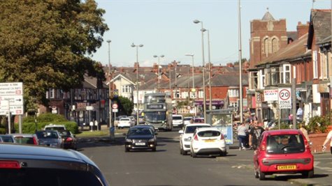
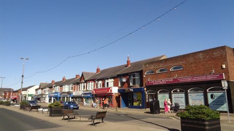
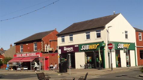
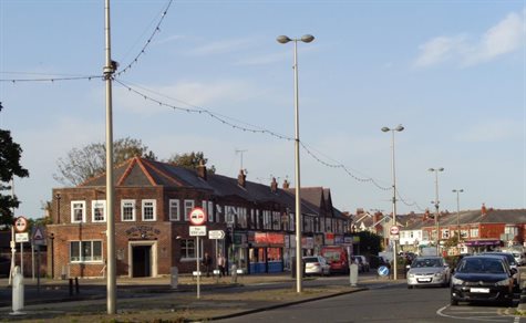
13.6 Westcliffe Drive
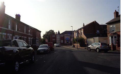
Westcliffe Drive runs north-south from Tesco Express (formerly site of the late 20th century Windmill pub and the Mill Inn prior to that) to Layton Square where it divides into Layton Road and Talbot Road. Historically the street was a main route from the north to the medieval Layton village. It was widened in 1963 and now forms the commercial heart of Layton. It is characterised by a mix of residential and commercial buildings, with residential streets feeding on from the east and west.
View north towards from Hoo Hill
Good example of Edwardian semi-detached housing at 77 - 87 Westcliffe Drive
Although the separate residential and commercial elements of Westcliffe Drive are of different townscape values the historic importance of the street and location of several locally listed buildings makes it of positive merit.
Adjacent to the church is the site of Layton Villa, which was demolished in the 1970s and replaced with apartments typical of this date and neutral in value.
1970s apartments on the site of Layton Villa adjacent to St. Mark’s Church
Numbers 52 – 60 Westcliffe Drive comprise an attractive red brick terrace with double height stone bay windows and stone detailing, mostly painted. Boundary walls and slate roofs with terracotta ridge cresting are intact. The block first appears on the 1932 OS map.
Numbers 36 – 50 Westcliffe Drive comprise four large red brick semi-detached dwellings with double height bow windows with gables. Boundary walls and slate roofs with terracotta ridge cresting are intact. The block first appears on the 1932 OS map.
Numbers 32 – 34 are a pair of later interwar semis, constructed to the same design as 2 – 4 Annesley Avenue with a dark red brown brick used to face the elevations and decorate double-height bays. They first appear on the 1938 OS map and are probably contemporary with the redevelopment of the site of the parks department’s nurseries where the purpose built shops now stand.
Numbers 63 – 91 Westcliffe Drive first appear on the 1912 OS map and all are residential. Numbers 77 – 91 comprise substantial red brick semi-detached houses with single height bow windows, decorated gables and stone detailing to windows and doors. They are of positive value. Numbers 63 – 75 is a substantial terrace with single height bow windows with rendered elevations to the first storey.
Numbers 53 – 61 first appear on the 1938 OS map. Numbers 53 – 55 is a substantial pair of semi-detached houses with double height stone bay windows and gables. The first storey is rendered. Numbers 57 – 61 are two pairs of semi-detached properties with single height bow windows.
All of the residential properties are of positive value. Besides architectural detailing typical of their period, they have intact roof coverings, many with chimneys, and boundary walls. These are important features in the historic townscape.
Numbers 53 – 61 Westcliffe Drive
Numbers 52 – 60 Westcliffe Drive
Numbers 32 – 34 Westcliffe Drive
South of Granby Avenue, Westcliffe Drive is divided by a central island, re-designed as a seating area and pedestrian zone with planting and bicycle parking. This area is defined by different coloured asphalt but there is no change in level between the road and island. The street has broad footways with a tight building grain of parades of two-storey shops on both sides. All surfaces are modern, including tactile concrete crossing points.
Shop fronts and fascias throughout the area are generally modern which undermines the host buildings. However, this is largely superficial and could be remedied, either on a case by case basis as part of development management or as part of a more wide scale shop front replacement scheme if the opportunity arises. Good examples of signage and shop front design have been highlighted earlier in this appraisal which could be used as references for future development.
Layton House at 3-5 Westcliffe Drive, formerly a bank, is a late 20th century flat roof red- brick block which is out of character with the two-storey red-brick terrace to the north.
Central island with street furniture opposite Layton Institute
Numbers 5 – 29 Westcliffe Drive
Numbers 5-29 comprises shops to the ground floor with bow bays to the first floor. The original grey slate roof is intact with a number of retained chimney stacks which add interest to the townscape. Number 21 was probably altered to form the Midland Bank in 1958 and, at the time the historic characterisation report was written in 2008, made an interesting albeit inconsistent contribution to the character of the townscape. Since then it has been joined with the adjacent betting shop at number 19 with very poorly designed signage which runs across the front of two differently designed shop fronts.
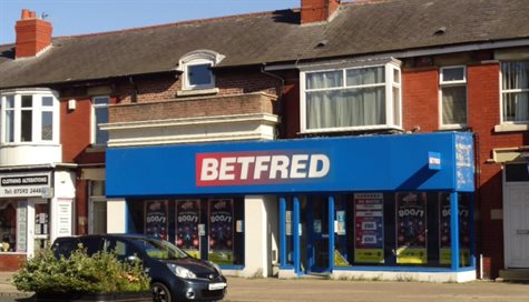
Inappropriate signage design
Numbers 31 – 33 is a former bank which has been divided into two units with modern signage which lacks appropriate division over the units. The butchers at number 35 is a good example of a shopfront and makes a positive contribution to the area.
Numbers 31 – 35 Westcliffe Drive
Numbers 37 – 43 Westcliffe Drive retain bow windows above the shopfronts with red clay tile roofs, although the windows are upvc replacements. Although the shopfronts and signage are modern they retain their historic proportions. Numbers 45 – 47 have upvc box bays to the first floor and external shutter boxes below the fascia of the shopfront, which together undermines the unity of the block. However, overall the red brick façade and hipped slate roof with terracotta ridge cresting make a positive contribution to the historic character of the townscape.
Number 51 Westcliffe Drive abuts the aforementioned block but is a separate building with a hipped slate roof with terracotta ridge tiles and retained chimneys. In common with all commercial properties in the area it has upvc replacement windows, and the use of the forecourt enlivens the streetscene, but the rendered facades, abundance of vinyl signage and the free standing illuminated pole sign undermine the historic character of the area.
Numbers 37 – 51 Westcliffe Drive
51 Westcliffe Drive
Locally listed Salem Layton Methodist Church with adjacent church hall
The interwar Salem Layton Methodist church is a local landmark. On the west side, numbers 2-28 form an attractive two-storey parade of shops, built in two phases in the 1930s of dark-red brick on the site of the parks department’s nurseries. The shop units are divided by brick pilasters with circular heads, but most now have modern shopfronts and signage. The range is positive in value.
Purpose built shops 2 – 28 Westcliffe Drive
Also on the west side of the street is the locally listed Jewish Cemetery (described earlier) an important open space with its chapel and railings. Adjacent to the north is the Layton Institute and related bowling green which are locally listed as a group. The building is practically in its original form and has strong townscape value.
14. Summary and conclusions
14.1 The grids and networks of Layton’s terraced streets, laid out following the opening of Layton Cemetery in 1873 up until the mid-20th century, are an important part of its character and gives it a suburban feel. This is enhanced by trees and green public spaces, and the different housing design types and qualities, almost all of which retain positive qualities due to lack of alterations, extensions or other significant works. These are qualities which should be preserved wherever possible and include original roof coverings, chimney stacks, bay windows, front boundary walls and gatepiers, all of which make a positive contribution to the townscape.
14.2 The reinstatement of lost features such as traditionally designed shop fronts and sliding sash windows should be encouraged to enhance the character of the conservation area.
14.3 Post war housing, and interwar housing which has a high level of alteration, has been excluded wherever possible in order to ensure the integrity of the proposed conservation area.
14.4 As Layton is not currently in a designated conservation area retention of historic features and the control of such things as the installation of solar panels will be difficult to manage in the longer term.
15. Opportunities for preservation and enhancement
15.1 The insertion of modern shop fronts and overlarge and inappropriate signage is one of the main negative issues within the proposed conservation area. However, upper floors are generally good and boundary lines have been respected. Shop front replacement and improved signage could be achieved as part of normal development management.
15.2 The loss of original joinery is the main negative issue on residential properties with the installation of upvc windows and doors. This is also reversible, and could be encouraged in line with existing conservation area guidance and window guidance. Original roof coverings and chimney stacks are an important feature in the area and would be afforded some protection with conservation area designation. Boundary walls are generally intact, possibly due to the fact that many front gardens are too small to accommodate off-street parking. An article 4 direction to give added protection to these historic features may be considered in the future.
15.3 The terraces of traditional working class housing in particular have low levels of façade alteration, and conservation area designation will ensure that this aspect of historic character is preserved in that planning permission would be required for cladding and painting the brickwork of front elevations.
15.4 Satellite dishes are also detract from historic character, and removing or re-siting these will be encouraged. Fixing satellite dishes to front elevations and front roof slopes will require planning permission.
15.5 Layton House is an intrusive modern element in the otherwise historic townscape and may present an opportunity for enhancement or more sympathetic development in the future.
15.6 A historic photograph dated c.1915 shows that number 28 Onslow Road was Little Layton Post Office with a shop front and mock Tudor gable (page 73 of Layton Historic Characterisation Report). This now white rendered residential property is prominent in the view east from Layton Institute. This view could be enhanced by careful consideration of the finish of this elevation when the opportunity arises.
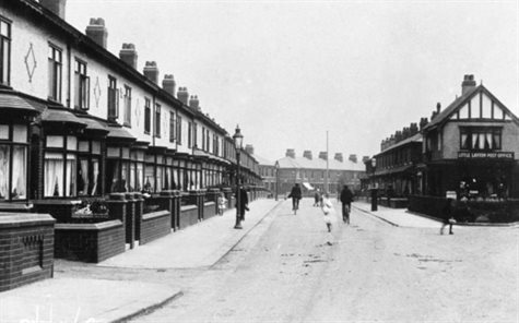
Nos 2-31 Onslow Road in c.1915 (courtesy of Ted Lightbown)
15.7 The two cemeteries and three bowling greens make a hugely important contribution to the open space in Layton which is otherwise densely built. It is imperative that these green areas are protected in order to preserve the amenity and character of the proposed conservation area. This could include the introduction of Tree Preservation Orders to ensure that any tree which needs to be felled due to being diseased, dead or dangerous is replaced.
15.8 There is a high level of visual clutter along Westcliffe Drive which has been exacerbated by the installation of benches and other street furniture on the central pedestrianised zone. There is also a high volume of traffic which, because of traffic calming measures, often brings the flow of traffic to a standstill at the busiest times. Although heavy traffic is to be expected in a commercial centre, which is also a main route through to Blackpool, some thought should be given to reducing visual clutter when the opportunity arises. The level of exposure to traffic pollution by pedestrians should potentially be reduced over years to come with the expected increase in electric vehicles.
15.9 The rear of 2 – 24 Melrose Avenue has a negative visual impact on views down Lynwood Avenue. Although conservation area designation generally controls development on front elevations, because these properties are most likely to be viewed from the street, planning applications for works to the rear of these properties would also be scrutinised to assess the impact on the character of the conservation area and be determined accordingly. This would also apply to any other rear elevations which are visible from the highway within the conservation area.
15.10 The late Victorian terrace 283 – 291 Talbot Road adjacent to the cemetery could be enhanced by creative remodelling of the front elevation of no. 283.
16. Next steps
16.1 Public consultation will now take place, with the possibility that boundaries may change as a result. The appraisal and boundary map will then proceed to the relevant cabinet member for approval and formal designation.
16.2 Thereafter a conservation area management plan will be prepared which will include recommendations for heritage protection, which may include the use of Article 4 Directions to remove a number of permitted development rights.